三国志地図
<<トップページへ>>
web上には意外と使える三国志地図がないんですよね。そこで自分で作ってみました。このページにある地図はいわゆる著作権フリーってやつです(財産権に限る)。フリー素材ってやつですよ。無断転載ぜんぜんオッケー。改変も二次利用もぜんぜんオッケー。その際、このページへリンクしてくれたらうれしいかなと思うけど、しなくてもぜんぜんオッケー。しわいこと言うなってなもんです。
一から自分で作ってみたいという方はこちらへ。三国志地図の作り方をご案内します。
地図説
三国志 年代別 群雄割拠図
- 190年
-
準備中
- 196年
-
準備中
- 200年
-
準備中
- 208年
-
準備中
- 219年
-
準備中
- 234年
-
準備中
基礎地図
白地図
- 白地図1
- 白地図2
- 白地図3
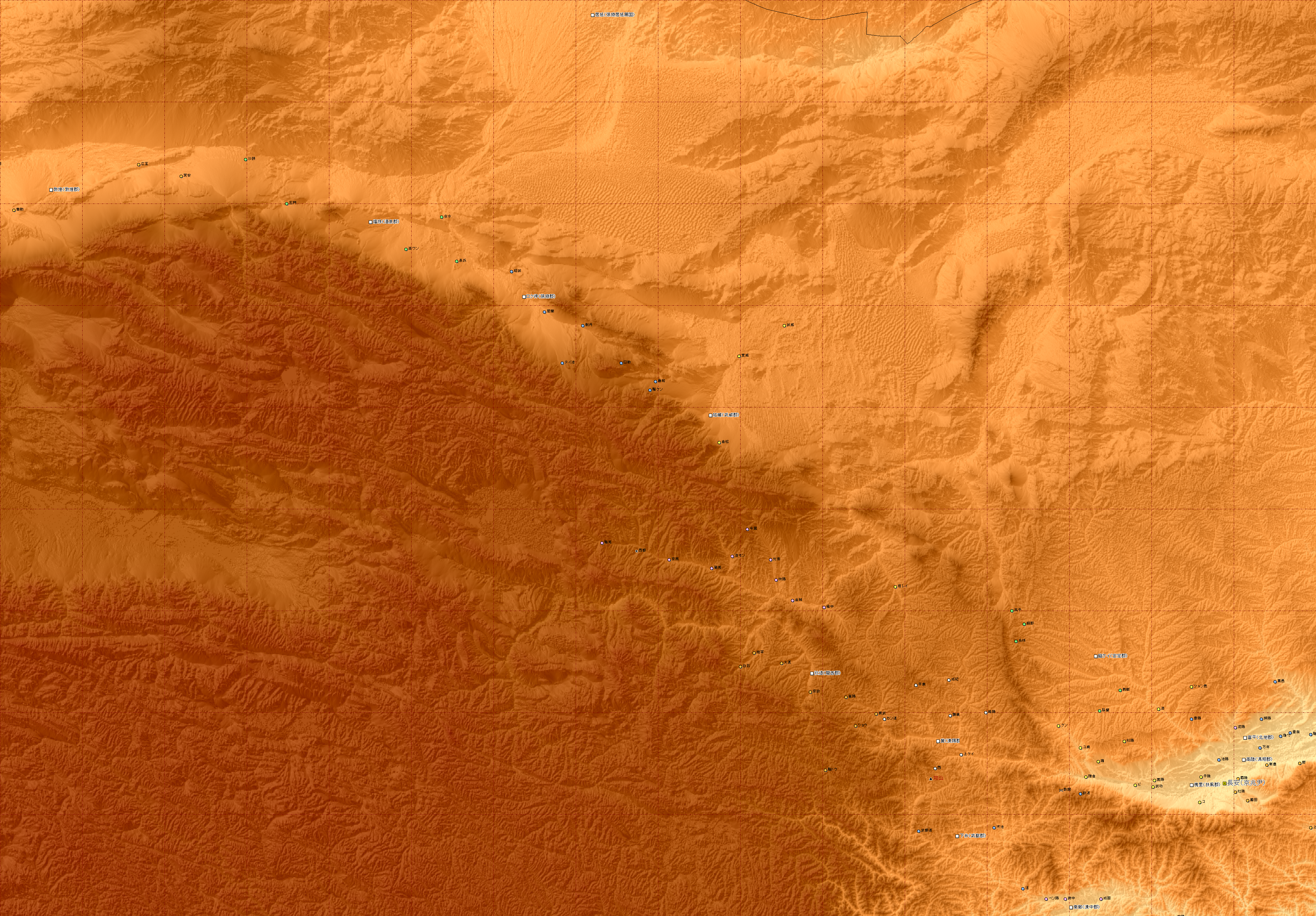
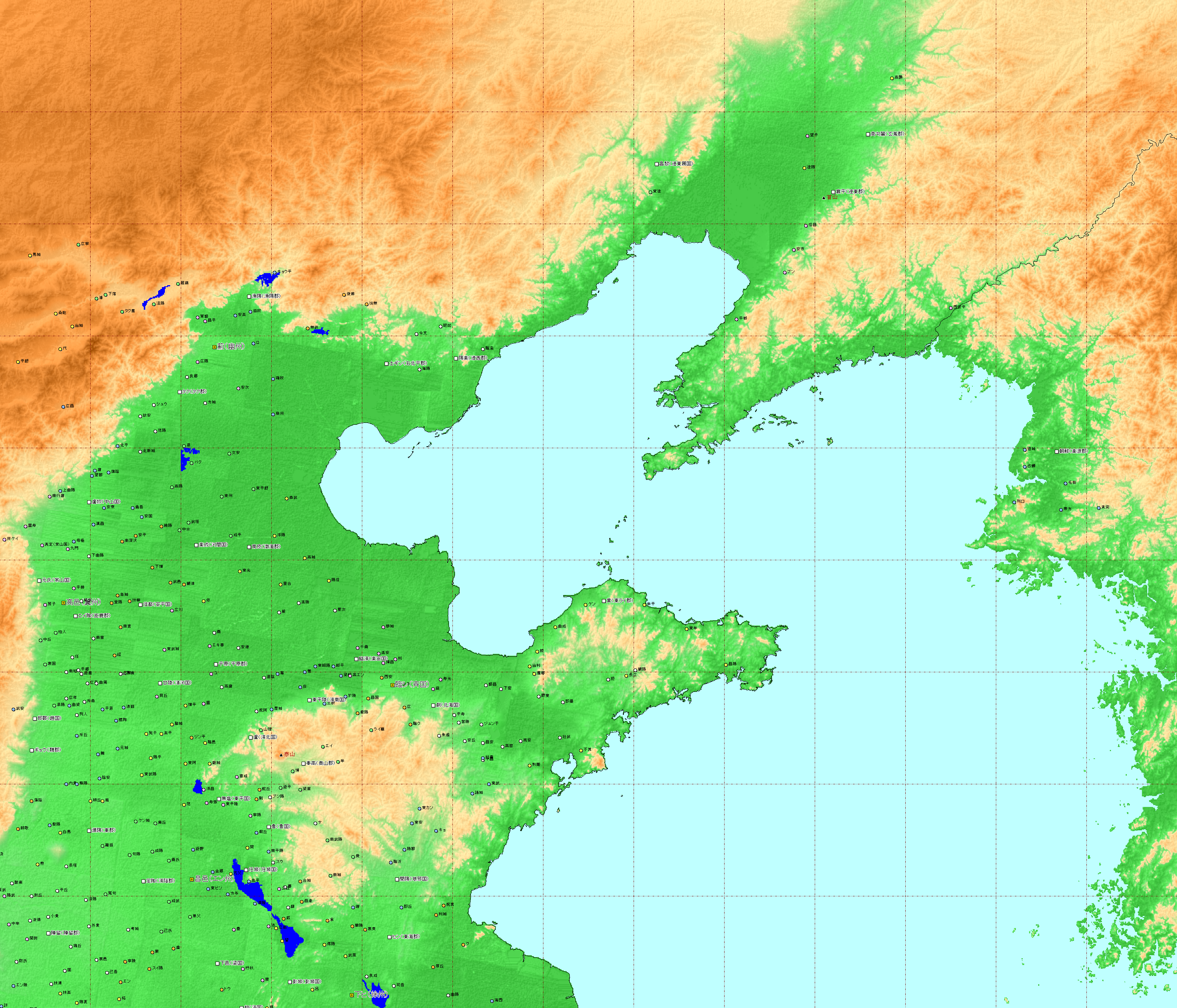
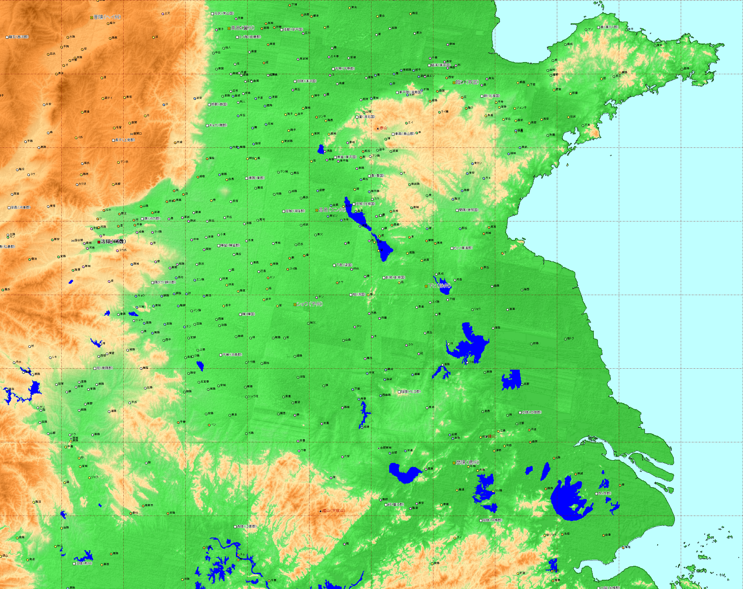
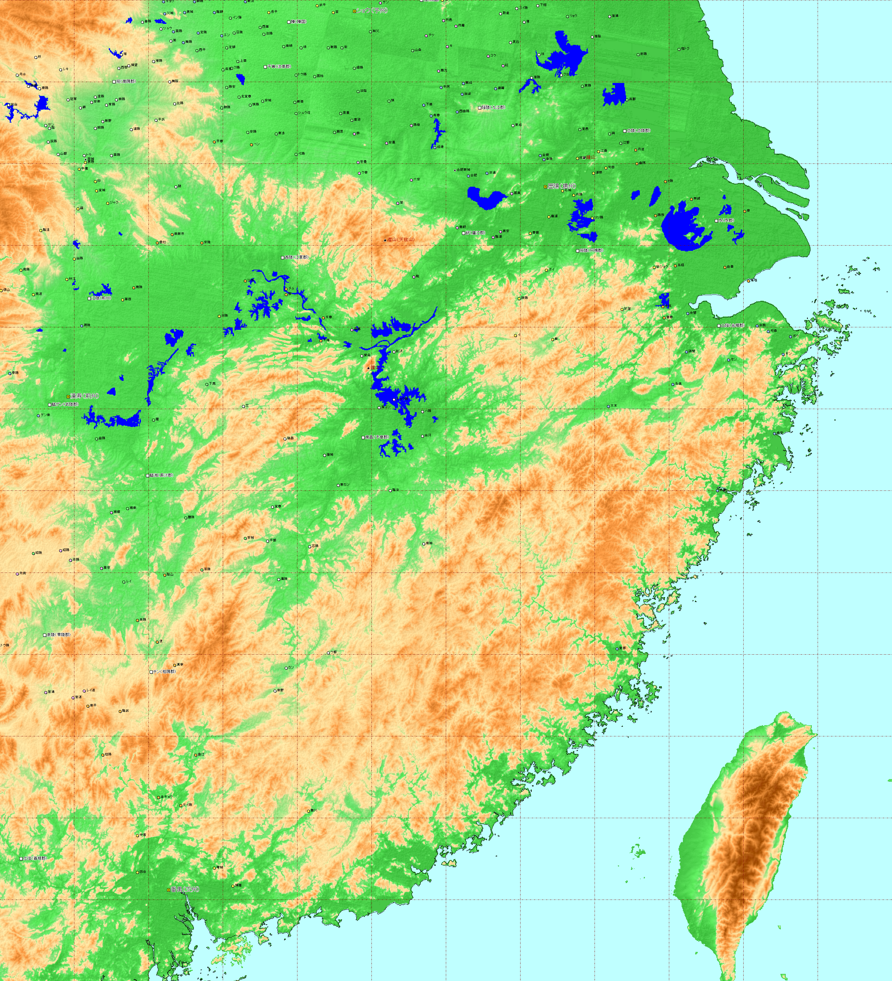
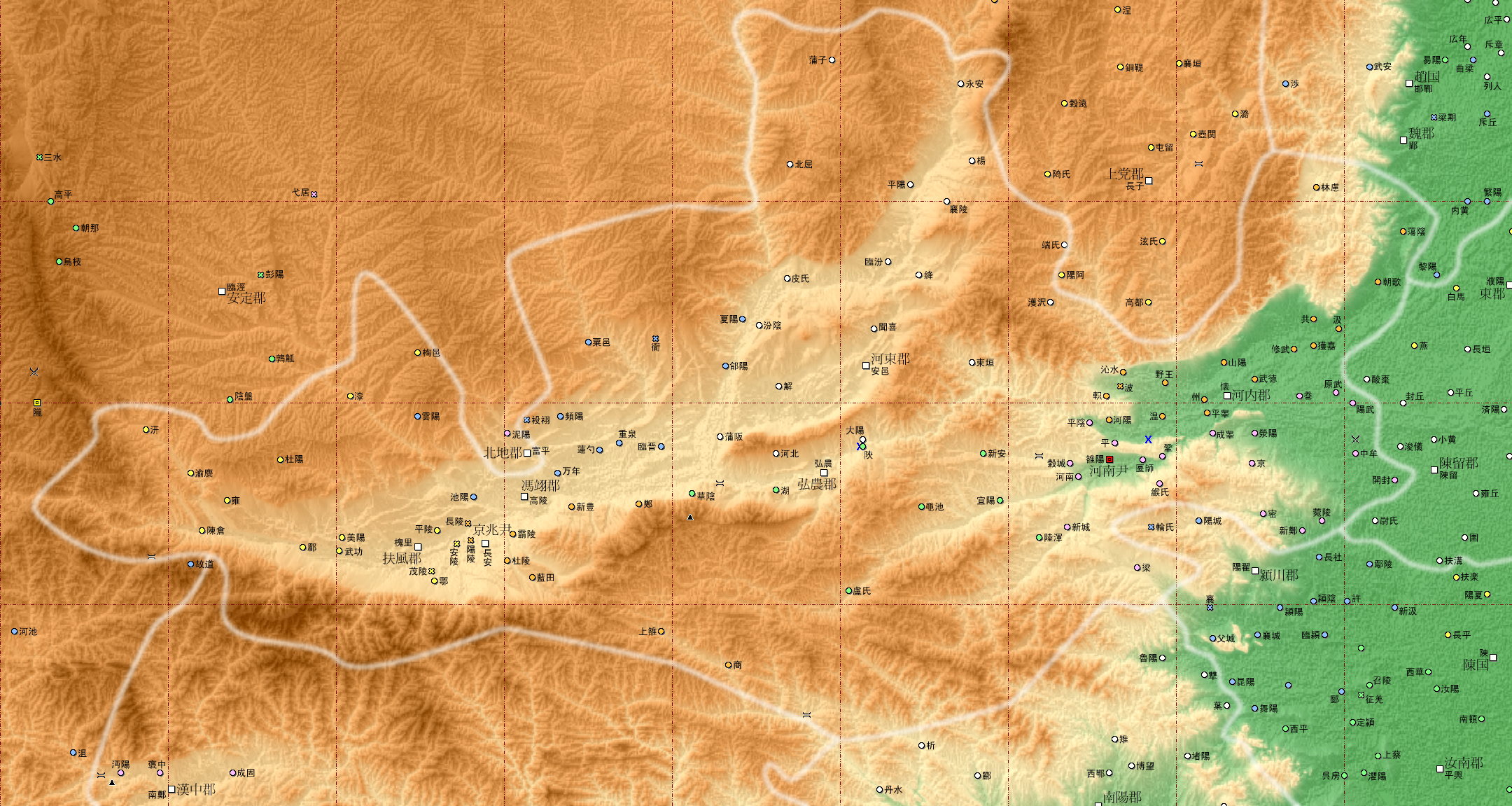
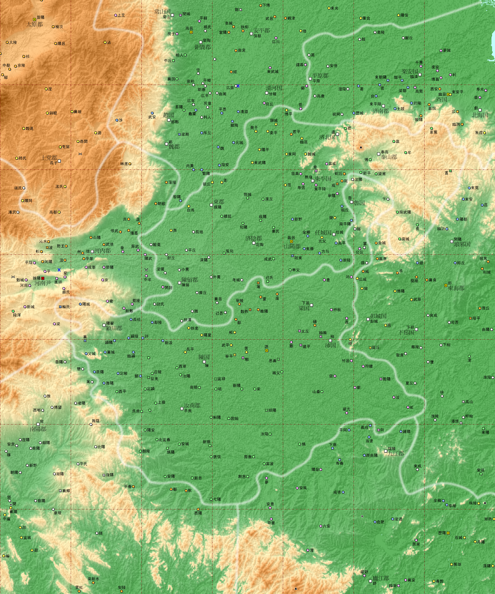
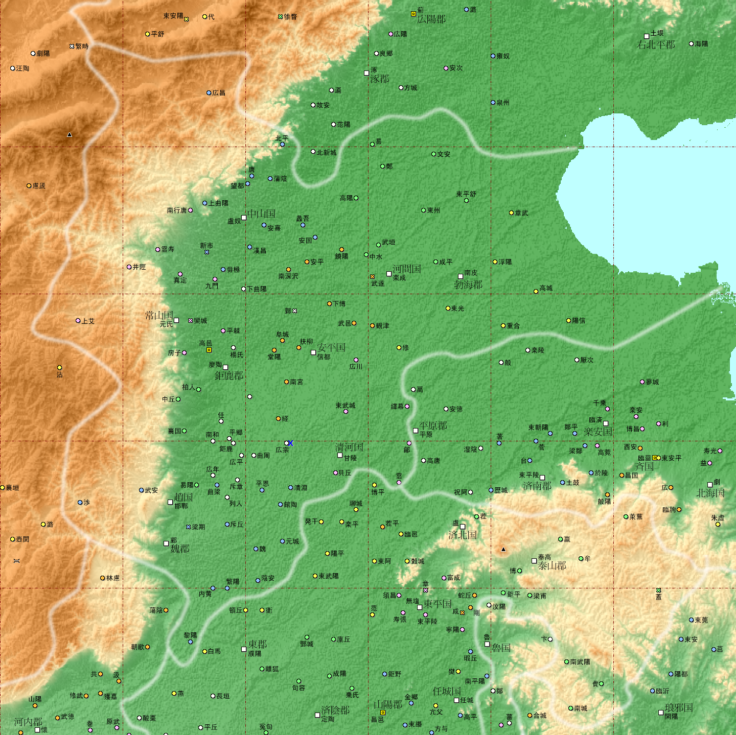
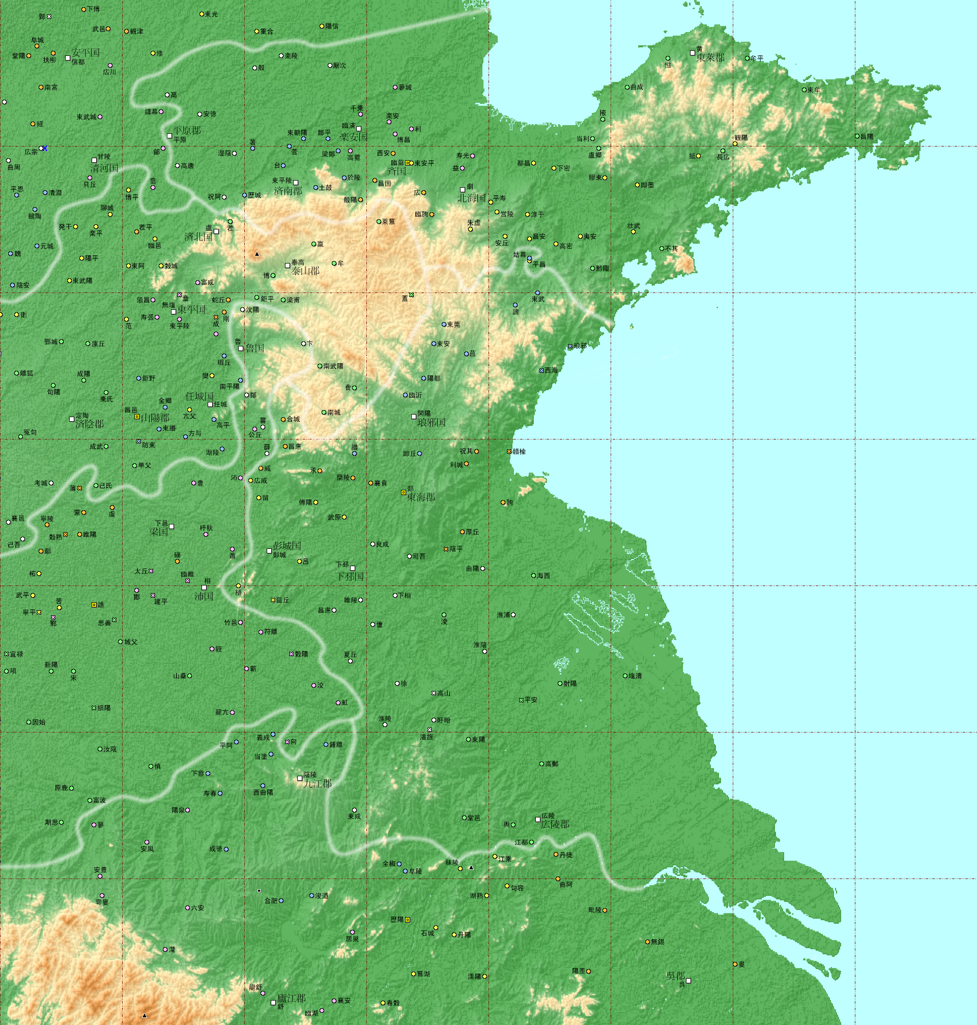
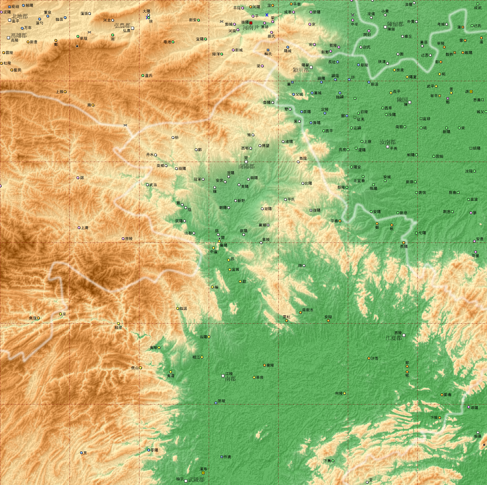
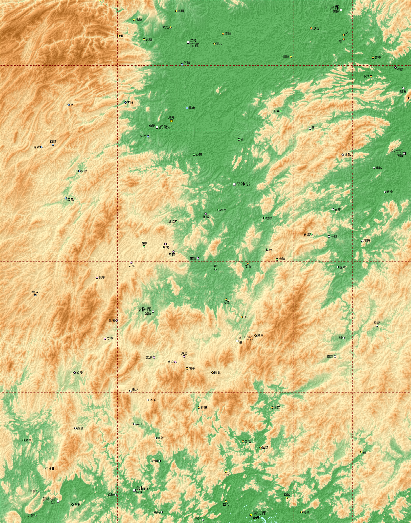
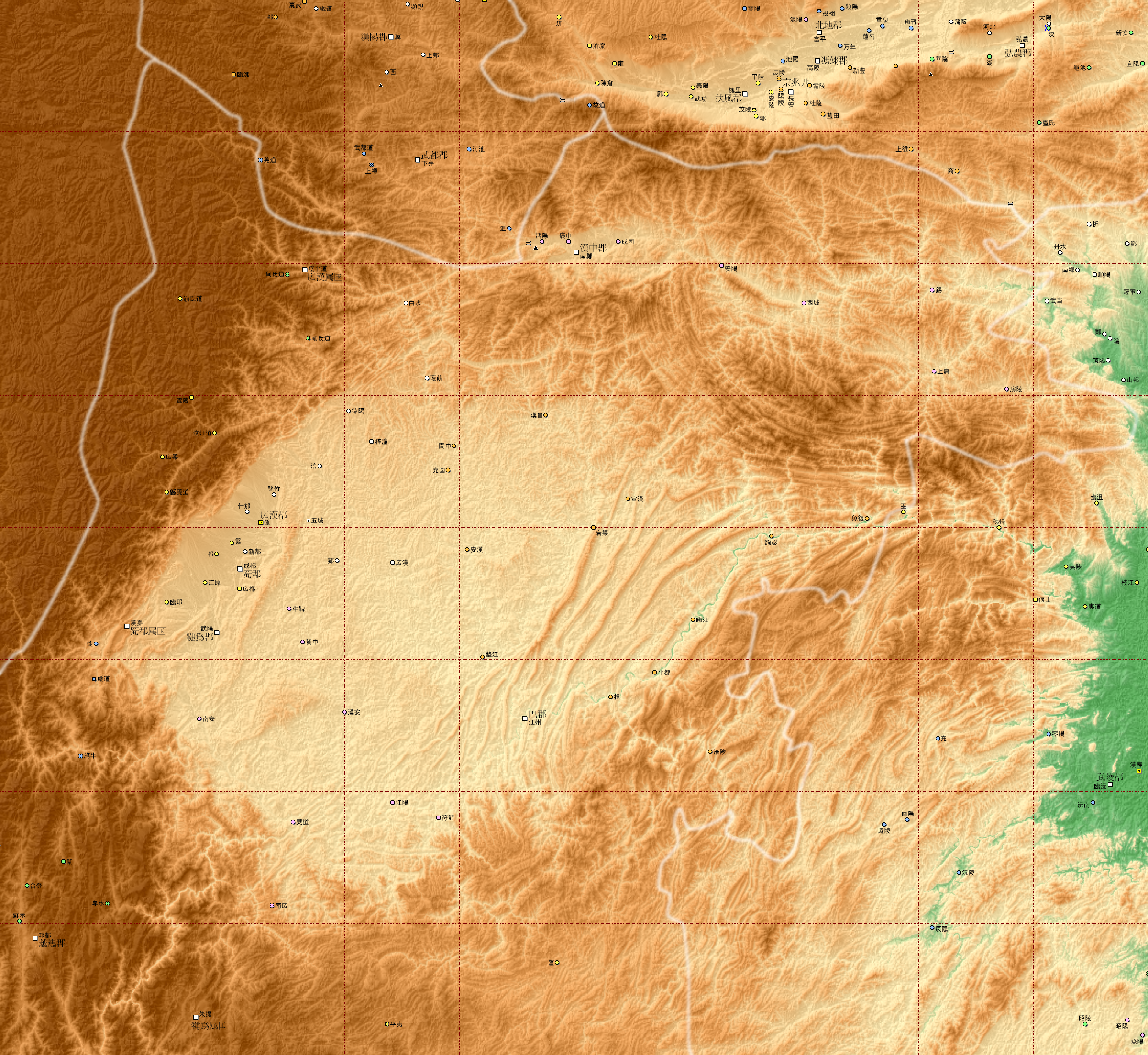
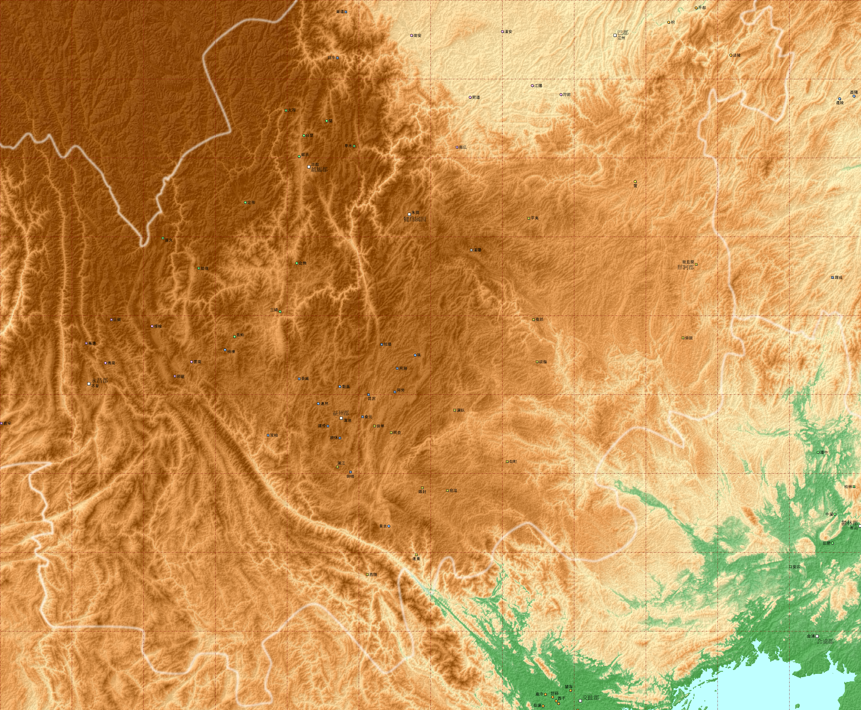
後漢書 郡県地勢図
現代中国の地勢図のうえに『後漢書』郡国志をベースとする地名を入れた。
こちらは古いバージョン。中国全土を大きく九つの地方に区切ったもの(そのうち四つを掲載する)。
- 西北部 (涼州) x:3840 px, y:2673 px, depth:24 bit/px, filesize:14,211,356 bytes
- 東北部 (幽州・冀州・青州) x:3119 px, y:2672 px, depth:24 bit/px, filesize:8,772,387 bytes
- 東部 (青州・徐州・兗州・予州) x:2879 px, y:2280 px, depth:24 bit/px, filesize:8,185,278 bytes
- 東南部 (揚州・荊州) x:2879 px, y:3168 px, depth:24 bit/px, filesize:12,448,749 bytes
新しいバージョン。州別に地図を切り出したもの。大きな州は2つに分けた。
- 司隷 x:2160 px, y:1151 px, depth:32 bit/px, filesize:3,296,279 bytes
- 兗州・予州 x:1680 px, y:2015 px, depth:24 bit/px, filesize:3,744,320 bytes
- 冀州 x:1440 px, y:1439 px, depth:24 bit/px, filesize:2,102,598 bytes
- 青州・徐州 x:1920 px, y:2015 px, depth:24 bit/px, filesize:2,731,953 bytes
- 荊州(北部) x:1680 px, y:1674 px, depth:24 bit/px, filesize:3,600,567 bytes
- 荊州(南部) x:1680 px, y:2136 px, depth:24 bit/px, filesize:5,181,358 bytes
- 益州(北部) x:2400 px, y:2207 px, depth:24 bit/px, filesize:6,868,654 bytes
- 益州(南部) x:2800 px, y:2376 px, depth:24 bit/px, filesize:9,048,899 bytes
<<トップページへ>>